
 English (UK)
 English (US)
 Deutsch
 Français
 Italiano
 Español
 Português
 Nederlands
 Dansk
 Norsk
 Svenska
 Suomi
 Eesti
 Latviešu
 Lietuvių
 Polski
 Čeština
 Slovenčina
 Magyar
 Slovenščina
 Hrvatski
 Srpski
 Română
 Български
 Ελληνικά
 Türkçe
 Українська
 中文
 हिन्दी
 Русский
App for foresters and forest managers
In the forest you see where you stand, what grows there and how much timber it holds. Parcel, trees, stumps and felled timber are recorded right on your phone.
Sound familiar?
In the forest you need answers at once
Paper maps, notebooks and retyping slow you down. And when timber is stolen or in a dispute, the evidence is missing.
- on site you do not know which parcel and stand you are in,
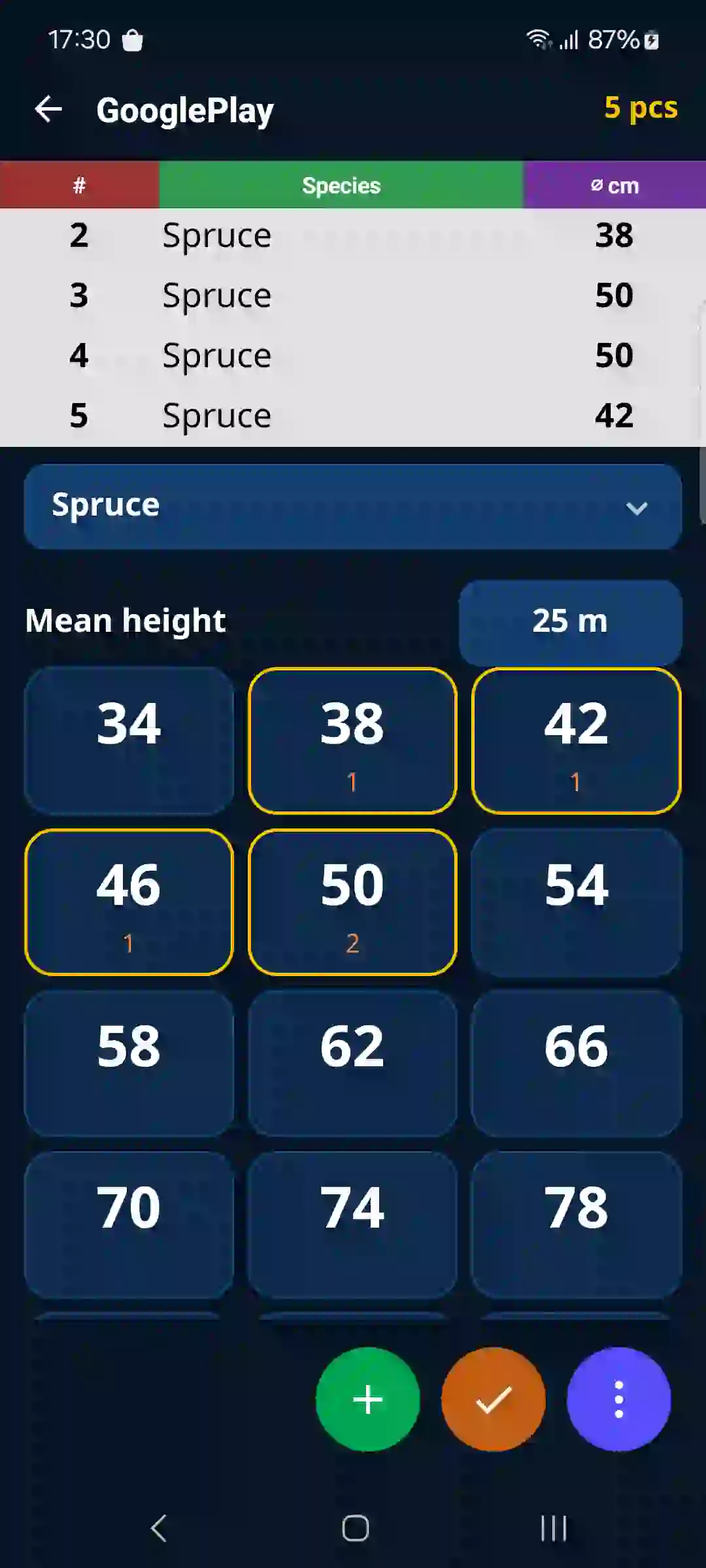
- standing trees and stands are measured on paper and retyped later,
- fresh stumps must be documented with a position, photos and a damage estimate,
- felled timber has to be measured and recorded.
What the app offers
Features you will use
Parcel and stand by GPSThe map opens at your position and shows the parcel, stand and boundaries from state maps – where the data is publicly available.More ›Standing trees and standsSingle trees or a diameter tally of the whole stand, with volume calculated by species.More ›Timber theft reportRecord stumps with GPS position, photos and estimated volume. The result is a report for the police or the insurer.More ›Timber origin for EUDRPosition and origin are saved with the tally and can be exported. The app prepares the supporting data; EUDR obligations remain yours.More ›
FAQ
Frequently asked questions
Does the forest atlas work in my country?
It shows cadastral parcel numbers from state maps in 24 countries. Which other data (stand, age, growing stock) you see depends on the country and on what the state publishes.
Can I measure standing trees without signal?
Yes. Tree and stump records work fully offline and the data is sent once you have signal again.
What does the timber theft report contain?
The position of every stump with its accuracy, two perpendicular diameters and an estimated volume, the owner, manager, time, reporter, damage estimate and photos.
The app for other trades
For logging and log tradeLogging contractor, forwarding, log trader, landingFor sawmills and lumber tradeSawmiller, lumber trader, log sawingFor joiners and wood product makersJoiner, furniture maker, carpenter, timber-frame and wooden house builderFor firewood and other wood productsFirewood, briquettes, pallets, packaging, wood componentsFor haulage and log transportHaulage and loading, log transport, carrier